Trefferliste "Großbritannien / Landkarte, Atlas" - alle Bücher
Ihre Suche nach dem Schlagwort "Großbritannien / Landkarte, Atlas" in Bücher ergab 7 Treffer.


Heinrich Stiefel
The British Isles and Ireland with UNESCO World Heritage Sites and National Parks (engl.)
sofort lieferbar
Karten
Aktueller Preis: EUR 12,90

Heinrich Stiefel
The British Isles and Ireland with UNESCO World Heritage Sites and National Parks (engl.)
sofort lieferbar
Karten
Aktueller Preis: EUR 17,90
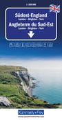
Kümmerly+Frey Regional-Strassenkarte Südost-England 1:300.000
sofort lieferbar
Karten
Aktueller Preis: EUR 12,95
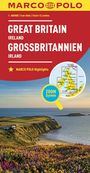
MARCO POLO Länderkarte Großbritannien, Irland 1:800 000
lieferbar innerhalb einer Woche
Karten
Aktueller Preis: EUR 11,99
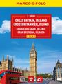
MARCO POLO Reiseatlas Großbritannien, Irland 1:300.000
sofort lieferbar
Buch
Aktueller Preis: EUR 19,95
Informationen zur Lieferbarkeit bzw. zu Veröffentlichungsterminen von Artikeln beruhen auf Vorabinformationen unserer Lieferanten. Diese Termine sind ohne Gewähr und können sich jederzeit ändern.