National Geographic Maps: Buffalo National River West Map (Karten)
Buffalo National River West Map
Karten
lieferbar innerhalb 2-3 Wochen
(soweit verfügbar beim Lieferanten)
(soweit verfügbar beim Lieferanten)
Aktueller Preis: EUR 14,46
Versandkosten
(United States of America): EUR 19,90
- Verlag:
- National Geographic Maps, 05/2025
- Sprache:
- Englisch
- ISBN-13:
- 9781566954051
- Artikelnummer:
- 9223722
- Umfang:
- 2 Seiten
- Nummer der Auflage:
- 2025
- Ausgabe:
- 2025th edition
- Gewicht:
- 90 g
- Maße:
- 233 x 106 mm
- Stärke:
- 7 mm
- Erscheinungstermin:
- 6.5.2025
- Hinweis
-
Achtung: Artikel ist nicht in deutscher Sprache!
Klappentext
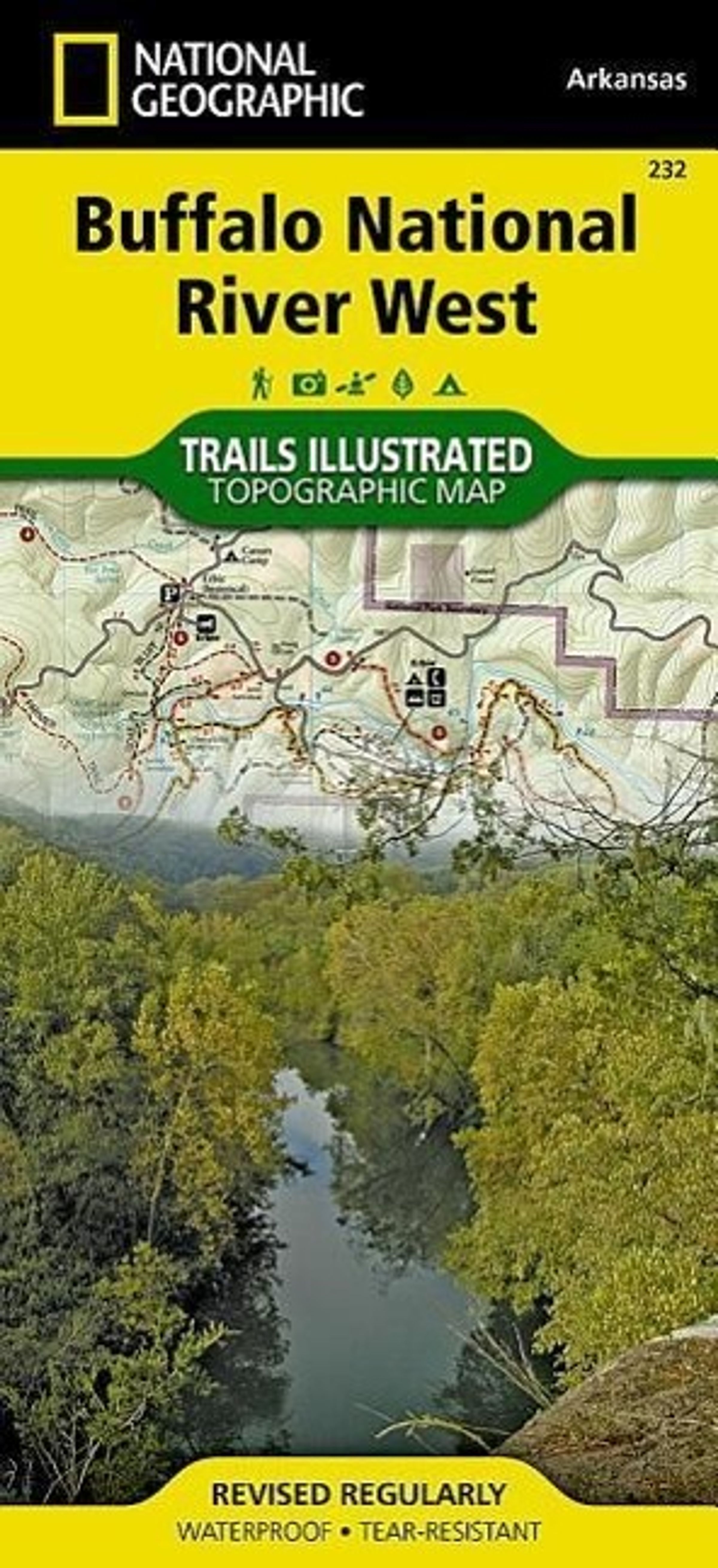
This Trails Illustrated topographic map for the western portion of the Buffalo National River and surrounding area in north-central Arkansas, one of the few remaining rivers in the lower 48 states without dams. The Buffalo National River, West, includes sections of the river from the Upper Buffalo Wilderness and the Ozark National Forest, through Boxley Valley to the Little Buffalo River, then through to Woolum. Along the way are many hiking trails, Lost Valley, Villines Farmstead, Steel Creek, Henderson House, Kyles Landing, Erbie, Cedar Grove, Ozark, Pruitt, and Carver. Includes UTM grids for use with your GPS unit.
Mehr von National Geogra...

![National Geographic Maps: National Geographic Road Atlas 2027: Scenic Drives Edition [United States, Canada, Mexico], Buch, Buch](https://wom.de/image/h90/front/0/9781566957069.jpg)

National Geographic Maps
Buffalo National River West Map
Aktueller Preis: EUR 14,46